May 27
May 28
May 29
May 30
May 31
June 1
June 2
June 3-5
June 6
June 7-10
We got up about 7. We got most of the packing done, then went down to breakfast. There were no seats left in the breakfast area. Thereís an Elderhostel group staying here, too.
So, we went back to the room, finished packing, and loaded most of the stuff into the car then tried again. There was one table open. I almost had to fight another couple for it... I intimidated them...
Our first stop after leaving the hotel was at a grocery store to pick up some Clif bars in case lunch gets missed again...
Then on to the Anasazi Heritage Center for a while. Thatís a very worth while stop. There was an exhibit on little pots that I found very interesting. They had several scientific exhibits, as well as artifacts. They even had a few microscopes set up around the room with specimens to examine. We wound up spending two hours there.
Then we walked up to Pueblo Escalante, half a mile up the hill from their parking lot. Itís a nice little dig overlooking McPhee Reservoir. The hike up there was just enough to give us some needed exercise.
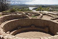
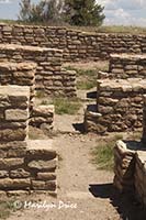
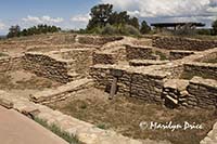
The three photos above were taken at Pueblo Escalante. The one on the left shows the kiva for this pueblo. The center photo shows a set of receeding doorways. And the photo on the right is an overview of this small pueblo, which probably sheltered a handful of families on this hilltop.
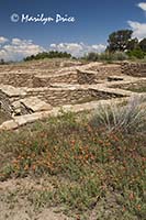
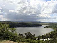
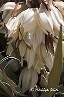
The photo on the left above is another view of Pueblo Escalante with some common globemallow in the foreground. The center photo shows McPhee Reservoir. The photo on the right is one of the many yucca plants blooming in the area.
Then we drove on to Canyons of the Ancients National Monument, which is a fairly new National Monument. It was one of those established when Bill Clinton left office in 2001. There arenít a lot of organized stops in this area and some of the land still belongs to private individuals, so itís definitely a work in progress.
Our stop here was at Lowry Pueblo. It was okay, but Iíve seen better.
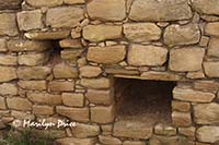
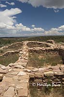
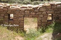
The three photos above were taken at Lowry Pueblo. The photo on the left is a detail of a portion of a wall, showing the rock work, which is not as intricate as that we saw at Chaco Canyon. The purpose of the holes is unknown. The center photo is an overview of some of the standing walls that remain. The photo on the right shows a doorway with two small holes (purpose unknown - windows?) that we went through. The opening for this door is only partially excavated and required crawling to get through it.
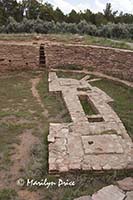
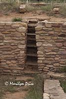 The photo on the left shows the interior of the Grand Kiva at Lowry Pueblo. Unlike other grand kivas we have seen, this one had several benches and other stonework on the floor of it. The photo on the right shows the ladder that has been built into what is normally the smokehole to allow access to the floor of the kiva. We passed on this opportunity...
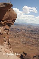
Our next stop was Needles Overlook, which looks into Canyonlands National Park. This is a very worthwhile stop to make. It has some nice views into Canyonlands. It would have been nice if we could have stopped here earlier or later in the day for more contrast, but itís still a nice stop.
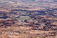
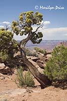
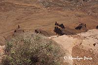
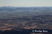
The three photos above were taken at the Needles Overlook. The one on the left looks deep into Canyonlands National Park. The green splash in the center indicates where the Colorado River travels through this park. The center photo is an old juniper tree on the rim of the overlook. The photo on the right is looking almost straight down to one of the many jeep trails located in the park.
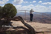
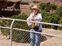
These three photos were also taken at Needles Overlook. The center one is one Carl took of me. The other two show Carl admiring the view.
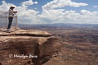
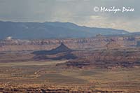
Three final photos of Canyonlands from the Needles Overlook. The photo on the left shows two formations known as the Six Shooters. The center photo is another overview of Canyonlands with an overhang in the foreground. The photo on the right shows the distant Needles formations.
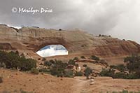
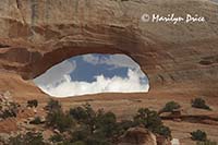 On to Moab, stopping at the side of the road for pictures of Wilsonís Arch, shown in the photos to the left and right.
We finally arrived at the condo. The turnoff for the condos is not well marked, especially if youíre driving in from the south, as we were. After turning around and backtracking, we found the particular condo quite easily.
We moved our stuff in, then went to the grocery store to pick up some supplies.
Back to the condo to settle in. I downloaded todayís photos and we both had some root beer.
Jenny and Jim arrived about 7. They moved their stuff in and we all went to supper at Pasta Jayís. Decent food, then back to condo to crash for the evening.

