May 27
May 28
May 29
May 30
May 31
June 1
June 2
June 3-5
June 6
June 7-10
Trying to get an early start after a late night isnít easy.... Weíre off to Rocky Mountain National Park for the day - at least, for as long as the weather holds...
We ate breakfast downstairs, taking our cereal and bananas with us. I can sure tell itís the weekend - the breakfast room was almost deserted at this hour.
We pulled out of parking lot to get gas and I kept hearing the road noises like a window was open, but they were all shut. We had left the back hatch open!!! Fortunately, the only thing that fell out was a water bottle and that was at the gas station - we drove back slowly over our route to verify... Back to gas station to top off tank.
We drove to Rocky Mountain National Park. Our first stop was at the first Visitorís Center - a building designed by a student of Frank Lloyd Wright.
While sitting in the parking lot, we realized that weíd forgotten to bring the Clif bars and extra water! A quick inventory showed that we had enough water for the day, but we really missed having the food along. I guess we were groggier than we thought...
At the Visitorís Center, I bought three books... Two more books on wildflowers in this region and one on where to go in Colorado for good photography. We also picked up park map and newsletter at the gate and continued on the Trail Ridge Road which snakes over the highest part of the park. It had just opened for the season about a week ago.
We made several stops along the road, stopping at most of the turnouts. At two of the stops, we added a layer. The temperature dropped drastically... We passed a number of bicyclists climbing the road!!!
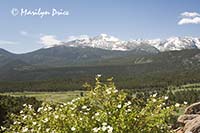
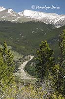 Our first turnout was at Many Parks Curve where we walked back to the boardwalk built for looking at the views. The photo on the left shows Long's Peak from this viewpoint. Long's Peak has been visible from several vantage points, including Longmont (when it wasn't shrouded in clouds). The photo on the right is a large waterfall that we spotted across the valley from this overlook. I never did find out what it was called...
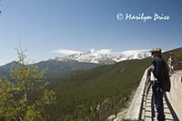
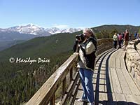 We had only added our jackets for wind protection at this overlook. Later, we would add sweaters under the jackets. The photo on the left shows Carl on the boardwalk at Many Parks Curve with Long's Peak in the background. The photo on the right shows me in about the same spot. Looks like I've found something to zoom in on...
.
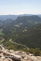
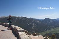
Our second stop was at Rainbow Curve, approximately half way up to the summit. The photo on the left shows the road we came up on snaking through the valley below. The photo on the right shows a bicyclist from Fort Collins taking a break and enjoying the view. He had a disposable camera with him and was taking some pictures from this viewpoint.
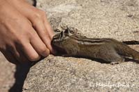
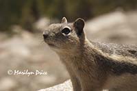 At Rainbow Curve, we saw several golden-mantled ground squirrels looking for handouts. Despite several signs admonishing people not to feed them, we spotted a couple of violations... The photo on the left is not one of them. A young boy held out his empty hands as if he were offering a treat and the ground squirrel had to take a closer look. This is still a dangerous thing to do. He could have gotten bitten... However, because they were looking for handouts, the squirrels would approach humans quite readily. I didn't have to zoom very far for the photo on the right.
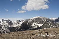
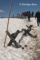
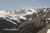
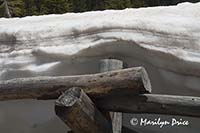
Our next stop was at Forest Canyon Overlook, which included a quarter mile trail out to the actual overlook. Part of this trail was still covered with snow (center photo above). I started to turn to Carl and remark that we probably wouldn't see any sandals on this trail, when I spotted a couple in hiking sandals followed closely by a young woman in decorative, slick bottomed sandals. I didn't say a word.... The other two photos show some of the wonderful terrain visible from this viewpoint.
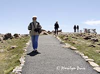
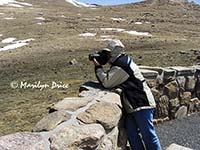
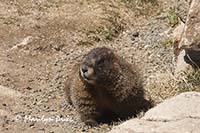
The three photos above were also taken at Forest Canyon Overlook. The one on the left shows me walking towards the overlook, bundled to the eyeballs! We added our sweaters after this stop... The center photo shows me taking a picture at the overlook. The right photo is a yellow bellied marmot that was posing for pictures (and eating lunch) at the side of the trail.
We also saw an elk cross the road as we were leaving this overlook. We didnít stop to take his picture, however, as he was too far away.
.
At the Tundra Communities Trail, we walked to top of the trail, almost. The wind was gusting to 40 knots wind and it was bitterly cold. On the way back to the car, I thought the wind would blow off my glasses... This trailhead had a pit toilet, so we both peed at 12,090 feet - first time for both.... The photo on the left shows the parking lot, snow bank, and restrooms.
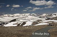
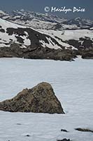
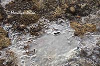
The three photos above were taken on the Tundra Communities Trail. The photo on the left looks across this tundra landscape towards the rest of the road towards the summit. The center photo shows a rock sticking through the snow and the mountains beyond. The photo on the right shows some ice we found on the side of the trail. Water was flowing below the surface of the ice.
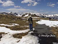
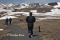
The three photos above were also taken on the Tundra Communities Trail. The photo on the left shows me taking a picture of Carl while he's taking the center photo, which is me taking his picture... The photo on the right is of Carl's back on the way back to the parking lot. It may not be obvious, but his jacket is inflated by wind...
We learned later that the temperature on this exposed top was in the mid 30s with a steady wind (at least 20 mph), gusting to 40 knots... This was an almost level hike and not a very long one, but, between the temperature, wind, and elevation, we were exhausted when we got back to the car.
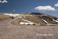 Once we thawed a little, we continued towards the summit. We made one more stop before the top - a quick one for a couple of pictures. The photo to the right shows the road approaching the summit.
Once we drove over the summit, we continued on to the Alpine Visitor's Center, where we stopped for a break (and lunch).
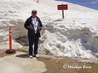
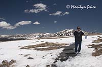
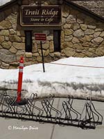 The photo to the left shows Carl standing next to a snow bank at the Alpine Visitor's Center parking lot. The cuts made through the snow here and along the road (where the snow plows had cut through to clear the roads) was 6-10 feet deep. The photo on the right shows a sight that tickled us - a bicycle stand. Notice the altitude at this location (on the sign in the background - click on the photo to see a larger view).
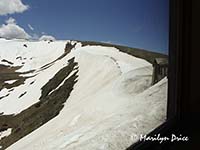
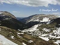 We had lunch at the Cafť in the Clouds at the Alpine Visitorís Center. BBQ sandwiches, chips, slaw. Nice view! We had a window table. I took the photo on the left, which was my view during lunch, then handed the camera to Carl. He took the photo on the right, which was his view during lunch.
I looked through their gift shop, but didnít find much that I couldnít live without. They had some keychains with flashing names that were solar powered. I almost bought one of each for the kids, but couldnít find Leeís name. I finally talked myself out of them...
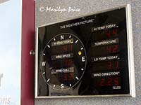 The Visitorís Center at this altitude is very nice. One sign inside (see left) gave the current weather conditions. Brrrrrrr.
They sure had a busy parking lot. Thought Iíd get run over on the way to the restrooms!
We continued down other side, not stopping nearly as often. Most of the maintained overlooks are on the eastern side of the park. We did see moose - twice - and two herds of elk.
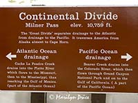
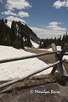
One of our stops on the way down the west side of the park was at a place where the Continental Divide crosses the road. The photo on the left shows a sign erected at this spot. The center photo shows a fence and a valley on the Beaver Creek side of this stop. The photo on the right shows what we saw out of our windshield when we parked here - snow and the tops of the fence posts!
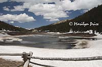
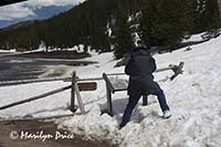 The photo on the left is Poudre Lake - its waters flow to the Gulf of Mexico from this point near the Continental Divide. The photo on the right shows Carl taking a picture of a sign (he wanted to look up some of the information later) near Poudre Lake.
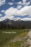
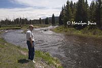 We stopped at one spot to look at a pretty little stream. When we got back to the car and looked at the map - that was the Colorado River!!! We could have waded across it at that point... The photo on the left shows the view from the side of the road, where we stopped to look at the river. The photo on the right shows Carl contemplating the Colorado River. Notice that the jacket and sweatshirt are back in the car...
We drove back to the Denver area over Berthoud Pass (11,000+ feet).
I tried to take us down this one road on the way back, but couldnít figure out how to get out of Central City... So we took I-70 back to town.
Since it was after six, we stopped at Sweet Tomatoes for an early dinner, then returned to hotel. There, we read the local paper and watched something forgettable on tv before bed.

