February 29
March 1
March 2
March 3
March 4
March 5
March 6
March 7
March 8
March 9
March 10
March 11
We packed up and checked out and headed for Lower Antelope Canyon, another place I had visited four years ago.
Carl had never been in a slot canyon before and was suitably impressed.
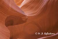
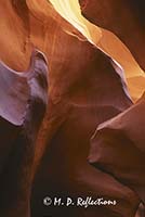
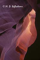
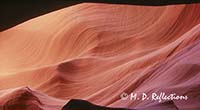
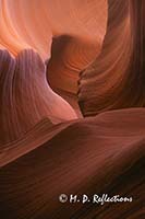
We spent about four hours in the canyon and walked the full length of it, taking pictures the whole way. I got into some interesting contortions with the tripod on that segment! We’d take five steps and stop for a photo. Fascinating place! Some of the photos from this morning follow:
Slot canyons are narrow sandstone canyons carved by rushing water. For most of its length, Lower Antelope Canyon appears to only be 10-25 inches wide on the surface. The canyon opens up underground, but remains narrow. Most of the length, the canyon is less than five feet wide at the bottom. And the surface is 15-20 feet above the bottom. The river which formed this canyon stretches almost 100 yards wide on the surface, until it hits this canyon. Then it suddenly dumps all of its water into the slot canyon, gouging out these fantastic shapes. Most of the year, this river is dry. However, a sudden storm miles away can trigger a flash flood. On the wide surface approaching this canyon, the water may only be an inch or so deep. But, when funnelled into this narrow area, it becomes a raging torrent and has killed those ignoring the warnings.
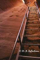
Before the waters exit the canyon, they cascade down this one last slide, then exit through a hole in the side of the cliff, creating a seasonal waterfall. The photo to the left shows this final descent and the two ways that people have been able to navigate it over the years. On the left is a set of hand and footholds - the original way this was traversed. Now, there's a modern steel stairway, which is occasionally washed from its moorings when flooded...
Then back to the Glen Canyon Steak House for another wine burger. Since it was about 2 pm, the burger was a bit drier than the day before, but still good.
Then we were on the road again. Destination this day was Zion National Park.
We entered the park through the southeast entrance, which goes through a 1.2 mile tunnel. Very interesting. The tunnel is narrow enough that motor homes and such need to make arrangements with one of the rangers stationed at each end to have the tunnel closed from the other direction so that they can drive down the center of the tunnel. Interesting logistics. The tunnel was completed about 1930 and was plenty wide enough for the vehicles of the day.
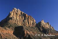
Out the other end and got a good sunset photo of the Watchman (photo to the right).
Then on to our hotel in Springdale, at the main entrance to Zion. We were scheduled to spend seven nights at the Bumbleberry Inn in Springdale.
We checked in and got settled in and cleaned up for dinner. Since it was late, we just ate at the restaurant associated with the hotel. It was okay, but nothing to write home about. They kept pushing bumbleberry this and bumbleberry that, claiming that the bumbleberry is a bink and burple berry that grows on a giggle bush. And if I have to listen to the explanation one more time, I’ll scream!!! Tasting the bumbleberry jam, I’d say that, if there is such a thing as a bumbleberry, then it’s related to blackberries, Marion berries, and Loganberries.
We crashed early.

