October 9
October 10
October 11
October 12
October 13
October 14
October 15
October 16
Sunday, October 9, 2016
We ate breakfast at the hotel, then packed up the car.
We spent most of day at Bryce Canyon National Park. There were a lot of tour buses – Japanese, Italian, French, German, heard some British, too, from the various tour guides and tourists. We tried to stay out of their way....
We did manage to stop at every overlook on the drive through the park and even got in a short hike. Carl's still nursing the IT injury in his right leg that he got about a year and a half ago, so we kept the hike short, slow, and lots of rest stops (and photo stops).
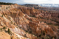
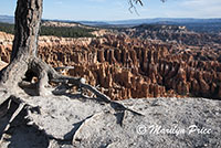
Our longest stop (other than the hike) was at our first stop at Sunset Overlook. It's a popular stop and, if you only stop at one overlook in the park, make it this one. We also walked part way down the Queen's Garden Trail, the most popular trail in the park.
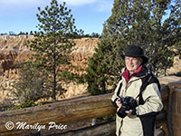
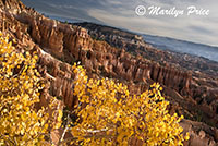
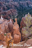
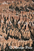
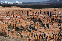
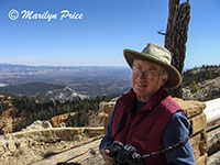
The photo on the left shows an iconic view of Bryce from Sunset Overlook. The center photo shows me at this overlook. The photo on the right was taken a little way down Queen's Garden Trail with a lone aspen in the foreground. The formations found the most in Bryce are called hoodoos.
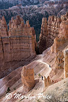
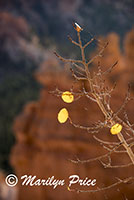
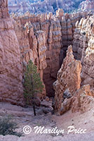
The photo on the left above shows Queen's Garden Trail from the Sunset Overlook on the rim of the basin. The second photo is a hoodoo called Thor's Hammer, which is just off of Queen's Garden Trail and very visible from the Sunset Overlook. The third photo has a couple of aspen leaves clinging to a branch with hoodoos in the background. The photo on the right shows how much colder the canyon walls appear if they don't have sun shining on them. This is the view of one of the side canyons part way down the Queen's Garden Trail.
.
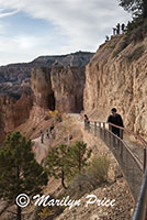
The photo on the left shows Carl making his way back up the Queen's Garden Trail. We only walked down the first quarter mile or so of this trail. It was as much as either of us could take today...
.
.
.
The photo on the left was taken at Inspiration Point, our second overlook. The other two photos were taken at Bryce Point, another overlook.
Once we had finished exploring Inspiration Point, we went looking for restrooms. Unfortunately, three buses had just pulled into the parking lot here, so we dropped back to the General Store to use the ones there. While we were there, we picked up sandwiches and chips for a picnic later in the morning.
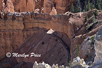
 The photo on the left shows one of the trails below Bryce Point as it goes through a hole in the side of the canyon wall.
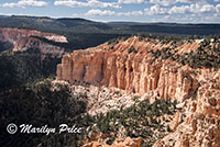
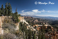
The photo on the right shows the rim of the canyon with the view beyond from Farview Point.
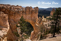
 The photo on the left shows another commonly photographed site at Bryce, called Natural Bridge. It's technically not a bridge, but an arch, but the name has stuck through the years.
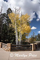
The photo on the right shows some aspens in full autumn glory. These were at the edge of the Natural Bridge parking area.
Our next stop was at the farthest point along the road where we found a picnic area. We had lunch here and looked at the sights from this overlook before starting on the shortest trail in the park, the Bristlecone Loop Trail. It was just over a mile in length and would take us up to the highest elevation point in the park.
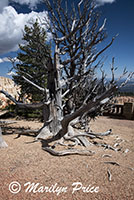
These three photos were all taken close to the half way point on this trail, where it was half a mile back to the parking lot regardless of which way you went. The photo on the left shows me at this overlook point. The center photo shows one of the many dead bristlecone pines we saw along the trail. The photo on the right shows that the hoodoos and other formation continue on for several more miles into the distance.
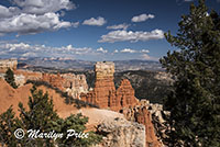
As we drove back from this farthest parking area, we stopped at a couple of overlooks that we had skipped on our drive up. Most had less interesting views than the places we had already stopped, but I did like this one photo from the Agua Canyon Overlook.
.
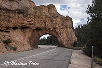
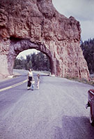
Finally, it was time to leave Bryce Canyon behind us. As we dropped back to the highway, we made one final stop at this short tunnel. It's one of two that were created to accommodate the road way back when Bryce Canyon became a national park. The interior is lined with colored concrete. The photo on the left shows how it looks now. The photo on the right shows the same scene as it appeared in 1956 when I visited the park the first time. That's my mother, younger brother, and me in this photo (along with the fender of our red station wagon!).
Then it was on to Kanab, Utah. The Comfort Suites there was very nice, but dinner wasn't that great. Most of the restaurants in town are closed on Sundays. One of the few open had two hour wait time and the other had vegan pizza!?!? The only other places to eat that were open were fast food (Pizza Hut, Wendy's, McDonalds). Don't try to eat in Kanab on a Sunday....
We wound up at the vegan pizza place and had really terrible artsy-fartsy sandwiches.

