June 13
August 22
Wednesday, May 30, 2012
The hiking year is getting off to an earlier start than weíve had the last two years. I planned a short (2.5-3 mile) hike to get back in the groove. We wound up hiking about four miles total, mostly uphill...
We left home later than usual (this is to be a short hike, remember?), pulling out of the driveway a little after 8:30, heading for Rocky Mountain National Park and Bierstadt Trailhead. Since we were later than usual rush hour, we drove through Boulder for a change. Much less traffic than the last time we tried that route...
I had read on RMNPís website that Bear Lake Road was mostly closed to traffic between 9 am and 3 pm, but the shuttles would be running out of the Moraine Visitorís Center, so the trailheads are all accessible. Well, I interpreted the posting to mean that the portion of Bear Lake Road between the main road and the Moraine Visitorís Center was fully accessible. Wrong. Most of the road was torn up and we had to wait for a clear lane before proceeding to the parking lot, which is fairly small. Not really adequate as a jumping off point for a day of hiking. We took the next to last parking spot...
However, we arrived just as they were boarding the bus that was ferrying people up Bear Lake Road, so there wasnít a long wait there.
We were soon on our way up the road and, after waiting for the ďFollow MeĒ truck at two different points, finally made it to the part of the road that was under construction last year. Smooth sailing from there.
We were among the first people to exit this particular bus, as most of the people were probably continuing on to the remaining two trailheads, both very popular jumping off points for a day of hiking.
So, about 11:15, we were on the trail. The first mile of this trail climbs the Bierstadt Moraine, a huge rock pile left by a retreating glacier many, many years ago. The switchbacks were fairly gentle and we made good time. The scenery from this trail, which is fairly open rather than wooded, is spectacular and well worth the visit.
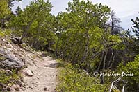
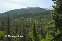
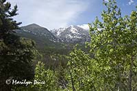
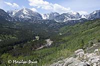
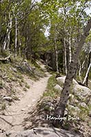
These three photos were taken along the Bierstadt Trail. The photo on the left shows part of the trail as it approaches an aspen grove. the center photo looks east along the valley towards the other side with lots of spring aspen. The photo on the right is the view towards the west towards the mountains above Bear Lake.
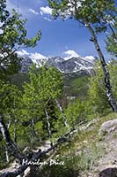
More photos from the Bierstadt Trail. The photo on the left shows the view towards the mountains through a stand of aspen. The center photo also shows these mountains, but from a clearer stretch of trail and shows the road that continues on to Bear Lake. The photo on the right is our trail as it enters another aspen grove.
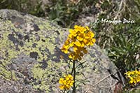
The photo on the left shows some western wallflower next to a lichen covered rock that was beside the trail.
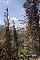
The photo on the right shows the mountains west of us through some pine beetle killed pine trees. The pine beetle damage is pretty bad in this part of the park.
We crested the moraine about an hour later and soon arrived at Bierstadt Lake. This lake, unlike most of the lakes in the park, was formed by the intersection of two moraines. Most were gouged by retreating glaciers and the resulting hollow filled with water.
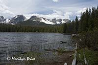
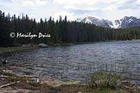
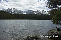
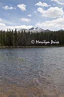
Bierstadt is a pretty little lake with very, very cold water! All I planned to do (originally) was to follow the almost mile long trail around the perimeter, then return to the trailhead by the route we came up on. However, we kept seeing signs for other trailheads that were less than two miles from Bierstadt, so we decided to explore a little. Especially since we had no real reason to return to our original trailhead - thatís not where the car was parked...
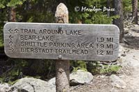
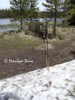
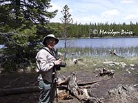
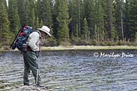
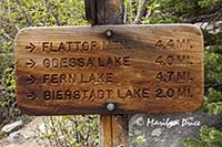
The photo on the left above shows the trail sign as we approached Bierstadt Lake. We'd hiked 1.2 miles to this point. Next we'd take the trail around the lake, popping over to the lake shore when the opportunity arose. The center photo shows one of the surprises we found on the first excursion to the shore - a pile of snow! Carl stuck his hiking poles into it and took this photo. The photo on the right shows me at the second shore site.
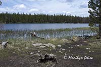
The three photos above are all different views of Bierstadt Lake.
Three more views of the lake, from our third shore location. The photo on the right shows Carl looking for some fish. He didn't find any...
So, we took our time and circled the lake, stopping about half way around to have lunch by a small bridge. We were back from the shore a ways to get out of the brisk wind.
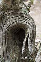
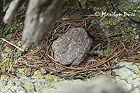
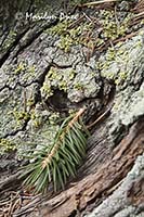
I took the three photos above after we finished eating - this dead tree stump had been overturned, exposing its twisted roots, right in front of the log we were sitting on for lunch. Lots of little photo opportunities there. I'll admit I moved the sprig of green needles, but not the rock.
After talking with some other people on the trail who had taken the other two routes before (one to Bear Lake and one to the Park and Ride area), we decided to continue on to Bear Lake, as that seemed to be the prettier trail.
It was a pretty trail, mostly uphill, as Bear Lake is at a higher elevation than Bierstadt. So, we did a lot of climbing today. Later, I looked up the elevations and we had a 900 foot gain between the Bierstadt Trailhead and the highest point on the trail before dropping down about 300 feet to Bear Lake.
There was a lot of storm damage along both trails. But the maintenance crews had been very efficient about getting the trails cleared. The windstorm that brought down most of the trees we saw down must have been within the last month, as most of the needles were still very green.
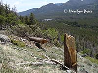
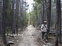
The photo on the left shows a snapped pine tree just off of Bierstadt Trail. Sprague Lake is in the distance. The photo on the right shows a dead tree in the middle of the trail ahead, on our way to Bear Lake (I'm trying to get out of the photo, but wasn't fast enough!)
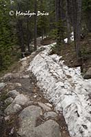
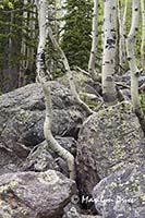
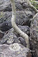
The three photos above were taken on the trail between Bierstadt Lake and Bear Lake. The photo on the left shows the one section of trail that still had snow on it. We didn't need the crampons, however, as the snow was fairly soft. The other two photos show some aspen twisting their way among the large rocks of the second moraine we scaled. Carl took one look at this area and called it a rock garden...
As we approached Bear Lake, Carl started wondering when the last shuttle picked up passengers there. He seemed to remember 5 pm and I couldnít remember at all!!! And it was 3:30 then... Turns out the last shuttle pickup from Bear Lake is at 8 pm, so we had plenty of time. Whew!
We had another minor concern. The sky was getting more and more overcast. The rain held off until after we left the park, but we wondered for a while.
Bear Lake is a pretty little lake thatís not far from its parking lot, so the nature trail around that lake (and the end of our trek) was almost wheelchair accessible and very well supplied with half log benches. And the leftover snow was down to the waterís edge...
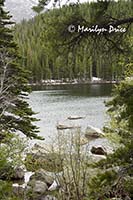
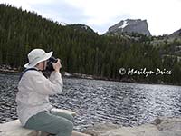
The three photos above were taken at Bear Lake. The photo on the left shows the trail sign near the shore of Bear Lake. The center photo shows our first view of Bear Lake. The photo on the left shows me sitting on one of the many log benches found at Bear Lake, taking a photo across the lake.
We arrived at the parking lot just as a shuttle bus pulled in! We went ahead and boarded. We didnít need to rush - it sat there for about 10 minutes before leaving.
We were soon back at the Moraine Visitorís Center. Our first stop was at the car to drop our gear and hunt for Carlís driverís license and senior park pass. I had had them in my lap after passing through the park entrance, but hadnít returned them to him. I couldnít remember what I did with them!!! In the confusion of searching trail guides when we thought the road was completely closed, they had slid off my lap and landed under the seat! It didnít take long to locate them, but I panicked for a minute.
Now that that was taken care off, we headed for the restrooms for a much needed pit stop!
We were feeling pretty good (physically), but the two hour ride home left us both a bit stiff. Sitting in a car for that long after a nice hike just makes all the muscles and joints stiffen. So, once the car was unloaded, we headed for the hot tub! Dinner was late tonight...
Will we return to this section of Rocky Mountain National Park this season? Probably. However, the smart way to do it is to take the Hikerís Shuttle from the Visitorís Center thatís just outside the park entrance (which runs about every half hour) to the Moraine Visitorís Center to catch one of the internal shuttles, which run about every 15 minutes, reversing that route on the way back. Much easier on the nerves....

