June 13
August 22
Wednesday, June 13, 2012
Thereís a major wildfire burning north of town, so we headed south!!! There was an article in Mondayís paper about wildfire trails in the area and Reynolds Park was mentioned, so that was our destination.
Reynolds Park is near the town of Conifer and is part of the Jefferson County Open Space program.
We got an early start, leaving the house about 8 am and arriving at the park a little after 9. Not a bad drive! However, the main parking lot was closed for repairs and wonít reopen until September 1! We continued to the secondary parking lot and found a bunch of cars...
Out came a gaggle of older women with their doggies... Chattering the whole time. We congratulated ourselves that we were taking a different trail.
So, we started up Hummingbird Trail, which starts fairly steeply up a hillside. After two switchbacks, the trail split. The right fork lead to a campground while the left fork was Hummingbird Trail. Which was closed because of the parking lot construction!!! All I could think, after looking at the map, was that they decided to close the entire length of the trail (1.3 miles) rather than just close the last portion of it that drops into the main parking lot and declaring it a dead end trail instead.
Of course, weíre nice, obedient citizens, so we turned back to follow the gaggle of women with their dogs, none of whom we ever saw again!
We wound up hiking along Songbird Trail (.5 miles) to the junction with Elkhorn Trail (.3 miles) to the junction with Oxen Draw Trail (.9 miles) to its junction with Ravenís Roost Trail (.9 miles) to its junction with the rest of Elkhorn Trail (.8 miles) back to the Songbird Trail for another .5 mile segment back to the parking lot! Whew! Or just under 4 miles total.
Oh, each time we passed the main parking lot, there was absolutely no activity - just a parking lot full of heavy equipment. And the only restroom facilities in the park were in this parking lot....
And we saw lots of wildflowers. Most of them were on the first half of the trail.
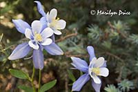
The Songbird Trail segment runs mostly along a small stream and was a quite pleasant start to the day. Most of the flowers here were Colorado Columbine, some yellow daisy like flowers, wild geraniums, and other open meadow flowers.
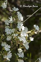
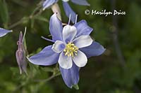
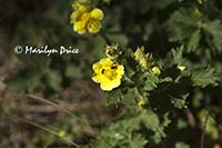
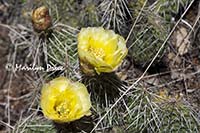
These three photos were taken on or near the Songbird Trail. The photo on the left is a Field Mouse-ear (related to chickweed). The center photo is the state flower, Colorado Columbine. The photo on the right is Beautiful Cinquefoil.
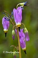
The first leg of the Elkhorn Trail and the Oxen Draw Trail were mostly uphill through a nice forested part of the mountain. The trail was fairly narrow and I managed to completely block it once when getting low to shoot a shooting star. Lots of forest type flowers here, including more columbine (both Colorado and spurless), wild roses, wild geraniums, shooting stars, some sort of berry (probably blackberries), and more.
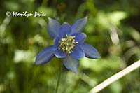
The three photos above were all taken on the Oxen Draw Trail. The photo on the left is a Spurless Columbine. The center photo is a Shooting Star. And the photo on the right is a grouping of Colorado Columbine with a blue spruce as a backdrop.
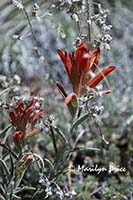
Ravenís Roost Trail was a complete change in terrain as it was on the more open side of the gorge we were hiking along. Here the vegetation was more arid with lots of prickly pear cactus (photo to the left), yucca, orange paintbrush (photo to the right), and other plants that like the dry terrain. It got very warm on this segment. I shed one layer during a rest stop....
.
.
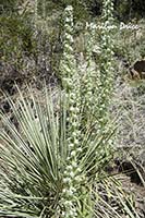
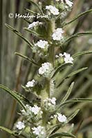
One stretch of the Raven's Roost Trail had a field of these tall flowers, called Miner's Candle among the yucca. The photo on the left shows how tall and slender they are, while the photo on the right is a closer view of the tiny flowers.
.
.
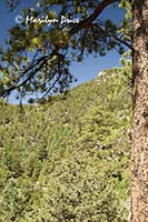
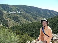
The photo on the left was taken just before we reached the highest point on Raven's Roost Trail and looks back at the hillside that Eagle's View Trail circles. We didn't include that segment in our hike today. The photo on the right is me at the highest point of Raven's Roost Trail with the view overlooking the valley the road follows to reach this park. At the extreme lower left is the main parking lot which was closed for construction.
.
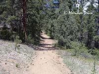
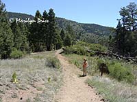
Once we crested a hill (still on Ravenís Roost), the terrain changed again. We were walking down (downhill) on a service road through the pines (photo on the left). Since it was late morning by now, the sun was nearly overhead and there wasnít much shade on this stretch. Not many flowers, either... The photo on the right is me at one of the trail intersections, where Elkhorn intersects Raven's Roost near the main parking area.
There werenít a lot of people on these trails, despite the number of cars in the parking lot.
We wound up back at the car a little after noon. So it was a short day.
We drove on down to Conifer (about 10 minutes down the road) for a very delicious lunch at Brooks Place Tavern. If you ever find yourself in Conifer around lunch time, this is an excellent stop. Prices were reasonable and the food was delicious! I had a stuffed toasted cheese sandwich (stuffed with cheese, tomatoes, avocado, and caramelized onions). Yum! Carl tried one of the house special creations called a lahoosh - similar to a personal pizza, but made on flatbread. Also very good.
We returned home a little after 2:30. A nice day! We werenít sure what kind of weather we would encounter down there, as the previous day, the smoke from the High Park fire was so thick in Westminster that we were having trouble breathing. But this day dawned with clear blue skies and very good visibility.

