Sept 22
Oct 1
Oct 6
Oct 20
Oct 27
Nov 3
Nov 17
Nov 23
Another Wednesday, another hike in the mountains. This time, our destination was Ouzel Falls in the southeast corner of Rocky Mountain National Park, an area known as the Wild Basin Area.
As usual, we left the house about and arrived at the parking lot about 9:30. It’s an overcast day, which should be great for waterfalls and cascades. It’s a little nippy (we donned jackets and fleece vests before leaving the parking lot), but the probability of precipitation is only 10%, so, we’ll see how far we get.
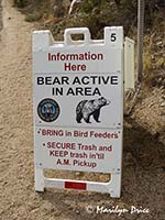
We spotted the sign on the left as we were nearing the entrance to this portion of the park. We didn't see any bears, but we could sure smell them...
This area is more rugged than the previous hikes and our knees would feel the difference before the day was over. It’s only rated at a 900 foot elevation change over the 2.7 miles to the Falls, but the guidebook didn’t mention that there were many ups and downs along the way...
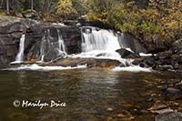
The first part of the trail is an easy walk through the woods to Copeland Falls, a small series of waterfalls just 0.3 mile up the trail. There are two levels to this waterfall - the Lower Copeland Falls and the Upper Copeland Falls. The Lower Falls are the more photographed of the two.
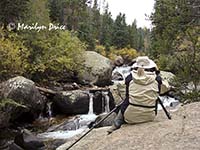
The photo on the left shows me settling in for some serious shooting at Lower Copeland Falls. The photo on the right is one of the ones taken here.
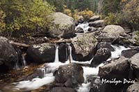
These photos show two views of Upper Copeland Falls on St. Vrain Creek. The one on the right shows the upper portion of the upper falls.
.
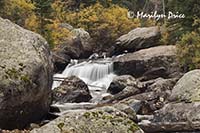
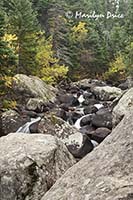
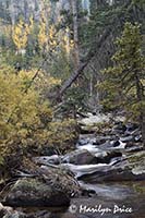
The next mile or so of the trail mostly parallels the St. Vrain Creek, occasionally leaving it to climb an intermediate hill. The creek tumbles merrily downhill, which gives you an idea what the steepness here is...
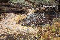
The three photos above show different views along St. Vrain Creek. The center photo has some leaves caught in a small pool of water.
At the 1.4 mile mark, we crossed the creek (nice bridge) and continued on to Calypso Cascades. These cascades are much more impressive in the spring (at least, that’s what the book says). There were other hikers standing at the prime photographic locations here, rearranging backpacks and chatting, so I thought I’d catch this one on the way back.
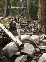
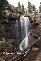
We continued on the remaining mile to Ouzel Falls. Well, from the trail, they’re just barely visible. One has to scramble up the hillside to get to a decent vantage point... The photo on the left shows the sign at the bottom of this steep scramble. Although the Falls are nice (photo on the right), I doubt we’ll be back to this one. We preferred the lower portion of the trail - up to the Cascades. Much prettier.
Between the Cascades and the Falls is an area that is recovering from a 1978 forest fire. Charred stumps and logs are scattered like pick-up-sticks across the hillside. However, the aspens, spruce, fir, and pines are making a nice comeback. Walking this portion of the trail is like walking through a Christmas tree lot in early December. Many of the evergreens were at least 20 feet high, but others would make nice Christmas trees...
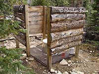
As we climbed the last set of switchbacks to the Falls, we were overtaken by a group of trail horses. We’d been stepping around horse manure all along the trail, but these were the only ones we spotted... Just before the Falls is a hitching rack and privy. Of course, Carl had to take a photo (left)...
We had lunch at Ouzel Falls and rested before heading back. While we were sitting there, I remembered that this would have been my father’s 85th birthday. Warm thought were sent to him...
While we were eating lunch, the clouds decided to part and sunshine came streaming down. Coats and vests were quickly stowed in the backpack...
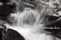
The journey back was fairly uneventful. However, remember my plan to stop at the Cascades for at least a record shot on the way back? Foiled again... When we got there, I found out that the sun was directly over the cascades. Any pictures of it would be into the sun and very, very full of contrast. Maybe we’ll come back in the spring when they’re more full... The photo to the right was one of the detail photos I managed to take here while attempting to avoid the glare.
All in all, it was a nice hike, but a bit longer and more rugged than we were quite ready for. I think we’ll come back to this one - at least for the lower portion of the trail - the creek, Copeland Falls, and the Calypso Cascades are definitely worth the hike.
It wound up taking us 3 hours to hike from the trailhead to the Falls and 2 hours for the hike back - mostly because I wasn’t stopping as often on the way back for pictures (g).
We stopped for smoothies on the drive home and hit the hot tub for a nice soak before dinner.

