Sept 22
Oct 1
Oct 6
Oct 20
Oct 27
Nov 3
Nov 17
Nov 23
We skipped our hike last week - there were too many medical and dental appointments that morning to make a hike worthwhile, so we drove downtown for the Denver Art Museum’s exhibit of King Tut artifacts. Very nice day!
So, this week, we were back hiking again. I had a bit of a chore deciding where to go this week and finally decided to try one of the many state parks. We left home at our usual eightish and drove to Eldorado Canyon State Park, a little south and west of Boulder. This wound up being much closer to the house than Rocky Mountain National Park - it only took a little over half an hour to drive there. We were on the trail much earlier than usual.
This would wind up being one of our shorter hikes - only 3.6 miles total - and one of the steepest.
Once entering the park, we drove to the trailhead for the Rattlesnake Gulch Trail. This climbs the side of Eldorado Canyon for 1.4 miles where there’s a sign for the former site of the Crag Hotel. From there, the trail continues another half mile to an overlook called Continental Divide Overlook. That section of trail is fairly flat and 1200 feet above the canyon floor.
From there, the trail takes a 0.8 mile loop back to the hotel before returning to the trailhead the way we came up. This loop is about half uphill before dropping back down. And fairly steep the entire way.
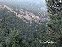
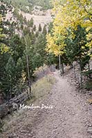
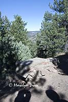
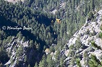
We had climbed about 1/3 of the way to the hotel when we heard a loud noise. It took a few minutes to figure out what it was. There was a reason it sounded like a laboring freight train - it was a freight train coming out of a tunnel high on the canyon wall above us. Later, we would learn that the highest point on the loop portion of the trail would wind up on the same level as those high train tracks and only about 100 yards away.... The photo on the left shows the freight train high above us. The photo on the right shows one of the more level sections of trail in this stretch...
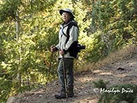
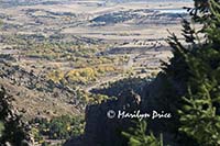
A little further along the trail, I stopped and took this photo (right) looking back towards Eldorado Springs, a small town at the mouth of Eldorado Canyon. Once I had finished, Carl took this photo (left) of me... As you can see, the trail is fairly steep.
We soon arrived at the Crag Hotel site. This hotel was built in 1908 and burned to the ground just four years later. It’s primary sponsors belonged to the Denver Auto Club, which would drive their “new” cars up the “road” to the hotel. This “road” was the steep, narrow trail we had just climbed. And those cars were new in 1908....
Other visitors to the hotel could arrive by train from Denver, then ride a funicular, or inclined railroad, to this plateau.
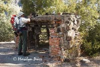
There’s not much left of the original hotel - we found only one wall fragment, the kitchen fireplace, and a couple of retaining walls. The fireplace had some found artifacts laying on top of it, including these china fragments (right). Garbage disposal was easy - they just pitched the scraps over the side.... The photo on the left shows Carl looking at some of the artifacts located near the fireplace.
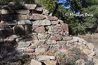
The photo on the left shows a wall fragment of this hotel (and our shadows). The photo on the right shows a fragment of a retaining wall. The hotel was built on a small plateau overlooking Eldorado Canyon. The location wasn't very big. According to the photos on the sign, most of the buildings were cantilevered over the canyon and retaining walls helped keep them in place.
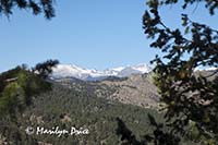
We continued along the side of a side canyon to the Continental Divide Overlook, which we had assumed would be the highest point on the trail. Wrong... From this overlook, we could look across another valley to the snow capped Rockies and (right), presumably, the location of the Continental Divide. In the valley far below us was a home that obviously belonged to someone very well to do....
We started up the loop trail that would eventually lead us back to the hotel site. Shortly after leaving the overlook, there was an unofficial trail branching off to the right leading to a ridge. Someone had dropped a small tree over the start of this offshoot, probably to discourage anyone from taking it, but it looked well traveled, so up we went.
It was only a short distance to the top of that ridge where we could look down into another canyon. This one looked completely uninhabited, but the crags and aspen in the center caught my eye (photo to the left).
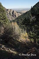
From here the trail continued up towards the train tracks. We stopped to catch our breath at one point and spotted the plateau for the hotel waaaaaaay down there... The photo on the right shows this view. The hotel was located on the small patch of brown just below the center of the photo.
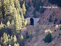
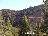
We soon arrived at the level of the train tracks and another unofficial trail took off from here. When the hotel was open, this provided access to a whistle stop for trains coming from Denver. We never did figure out what route the trains took to get here. This was about 1500 feet above the valley floor and the tracks emerged from a tunnel. Trains don’t climb very well, so there must have been some miles devoted to climbing to even get to this elevation. the photo on the left shows the tunnel leading out of the mountain and the photo on the right shows the tracks across the top of this valley.
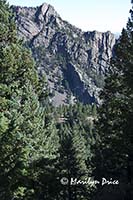
From here, the trail headed back down Rattlesnake Gulch to the hotel. The photo on the left was taken from this segment of trail and shows the entrance to the canyon and some aspen near the trail.
As we traveled through this portion of the trail, we were startled to hear a cell phone ringing! Carl's cell phone. It was his doctor's office calling to discuss his latest set of lab results... So, we stood there for a few minutes while he got that taken care on.
We then returned to the hotel site where we sat at a convenient bench placed next to the trail and ate our lunch before descending to the trailhead.
As we descended, we kept hearing voices... There were climbers on the steep canyon walls near the entrance to this canyon and, periodically, one of them would yell “On belay”, which signals to the person on the safety rope that the climber is going to descend rapidly using a belay technique.
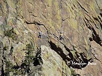
As we neared the trailhead, we finally spotted a small party of rock climbers on the face of the cliff. In most of the pictures we took, they look like a piece of lint on the photograph. Two of them show up fairly well in this shot (right), however.
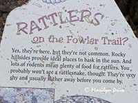
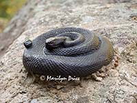
Near the trailhead was a sign (left) warning that Rattlesnake Gulch does, in deed, have rattlesnakes. It was too cold for them this day, however. However, someone had placed a small, life-sized statue of a rattlesnake coiled on a rock near this sign (right).... I had missed it on the way up, but caught sight of it out of the corner of my eye on the way down. Startled me!
Fowler Trail is a small trail connecting the trailhead with the actual start of Rattlesnake Gulch Trail, hence the references on this sign.
We were back to the car by 1:30, much earlier than our usual end of a hike, so we drove on up the canyon to the very nice Visitor’s Center and looked into some of the history of the canyon and the hotel.
Between the shorter hike and the shorter driving distance, we were home by 3 and hit the hot tub immediately. Then sat around wondering what to do the rest of the afternoon....

