April 10
April 11
Thursday, April 10, 2014
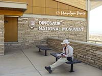 After a good breakfast here at the motel, we headed back to the main entrance to the park. We got there before the rangers had officially opened the Visitor’s Center. However, the door was open, so we walked on in. They had a meeting going on, but allowed us to wander around.
Access to the Bone Wall is restricted. This time of year, the rangers lead a caravan to the building housing the Bone Wall and give a semi-guided tour. During the summer months, there’s a shuttle every 10 minutes and no personal cars allowed beyond the Visitor’s Center.
So, we followed the rest of the vehicles to the top of the hill and entered the Quarry Building. Very interesting.
I had been here once before, about 50 years ago. Turns out this building was opened only a few years ago. The previous building, the one I saw, had just opened when I was here before and was built on a not so good foundation. It was condemned... The new one has a foundation that extends over 40 feet to the bedrock.
Another difference between the two visits - back then, they were still removing bones slowly from the face of the wall. About ten years ago, they decided to preserve the remaining bones in situ so that people could see how they are found in the wild.
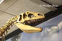
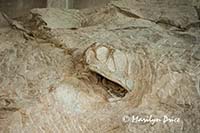
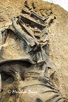
The photo on the left shows a cast of an allosaurus skeleton that was on display in the main room of the quarry building. The photo on the right shows a camarasaurus skull still embedded in the Wall of Bones. The casts are touchable while the actual fossils are not.
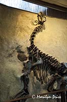
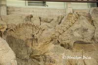
The photo on the right above shows a cast of a skeleton of a juvenile camarasaurus found on the Wall of Bones originally. It's unusual in that this is exactly the way it appeared when it was embedded in the wall. The center photo shows a couple of spinal columns near the top of the Wall of Bones. The photo on the right shows a jumble of assorted bones still embedded in the wall.
Why are all these bones found in this one location? Many eons ago, this area was a large bend in the river (which still runs nearby). Dinosaurs were swept downstream during floods and piled up in the accumulating sand that marked this bend in the river and were subsequently buried. As the years passed, the bones became fossilized.
After the tour of the building, we could either drive back out or walk down one of the trails in the area to see some fossils out in the open. However, if you follow the trail to the bottom of the hill, you have to walk back up the hill to retrieve your vehicle!
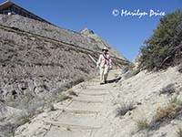
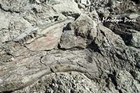
We opted for the shorter hike, which took you out to the closest raw fossils, then double back to the parking lot. Much better. The photo to the left shows me on the steps at the top of the Fossil Trail. The quarry building can be seen at the top of the photo. The photo on the right shows a large fossil bone. It's unclear which leg bone this is (front or rear). It was hard to see, which emphasized how hard a time the original paleontologists have finding fossils!
After retrieving our car, we went on a driving loop through this side of the preserve. While most people only visit the quarry, this is but a small portion of the monument’s grounds. However, to see most of it means driving out and around back roads through some pretty remote countryside. The auto tour, however, took us through the more developed part of the park.
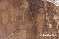
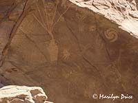
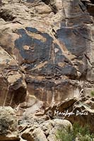
We stopped at two sites which had petroglyphs, very nice ones.
.
These two photos were taken at the first petroglyph site.
.
.
.
The photo on the left shows an unusual petroglyph. It depicts a very large lizard. Several other lizards can be seen nearby. The meaning of this symbol is elusive. The park rangers didn't know what it meant.
.
.
.
Then we continued on around the loop to the pioneer home of Josie Basset. She was quite a character! Most of the time that she lived in this location, she lived alone. She had at least five husbands over the years - divorced four of them and outlived the other. She was about 40 when she moved to this area, and ranched and farmed for close to fifty years after that!
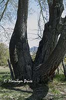
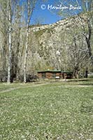
We had a picnic lunch here under some huge cottonwood trees, one of which is shown at the left above. The photo in the center shows Josie's log cabin.
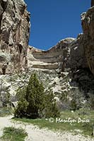
There are two box canyons near her house, one of which is shown in the photo on the right above. She kept her cattle (some of which were rustled) in these box canyons by building a fence across the mouth of each one.
After leaving Josie’s place, we dropped down to a couple of the campgrounds on the Green River, just to see the view.
We had planned on doing more hiking, but it was a very hot day and the trails had zero shade. So, we did some sightseeing. We drove up to Flaming Gorge Dam. Neither of us had ever been there, so it was a treat. That area is very pretty. We may have to explore it more.
.
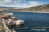
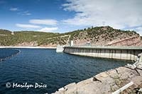
The photo on the left shows some of the reservoir behind the Flaming Gorge Dam. The photo on the right shows the top of the dam with some of the water behind it. Both photos were taken from about the same spot, just rotating about 90 degrees.
.
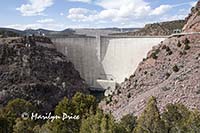
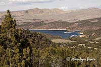
The photo on the left shows the Flaming Gorge Dam. The photo on the right shows the reservoir from the access road we came in on.
Then drove back to town.
Dinner tonight was at the 7-11. No, not the convenience store. This was a restaurant that had been in the same site for over 50 years and was named for dice, not the hours of operation. Much better food. Plain cooking and homemade “scones” (they were really biscuits). And half the place was a souvenir shop!

