May 19
May 20-21
May 22
May 23
May 24
May 25-26
May 27
May 28
May 29
May 30
May 31-June 1
June 2-3
June 4
June 5
June 6-8
When the alarm went off this morning, I thought it was part of a dream.... I finally realized what was going on and whacked it. Later, I found the off button so it wouldn't alarm again...
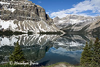
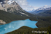
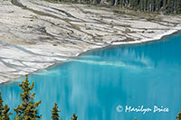
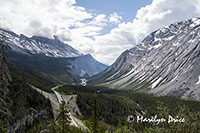
After breakfast, we drove north onto the Icefields Parkway and spent most of the day driving that. We made several stops for photos, including Bow Lake, Peyto Lake, and many roadside pullouts along the way.
Most of today is spent inside the boundaries of Banff National Park. The Icefields and Tangle Falls are in Jasper National Park.
The photo on the left is the ever lovely Bow Lake with some nice reflections. The center photo is the iconic view of Peyto Lake, famed for its unusual shape and unusual color. The photo on the right shows some of the runoff from Peyto Glacier running into Peyto Lake.
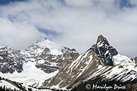
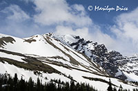
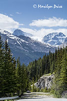
These three photos show some of the views we were driving through on this morning.
The mountains kept posing for me!
We got to the Columbia Ice Fields about 11:30 and stood in line for tickets for the Glacier Adventure, a special bus ride out onto the Athabasca Glacier. We had almost 35 minutes to kill before boarding the bus that would take us to the bus, so we spent it in the gift shop... The place was overrun with Orientals...
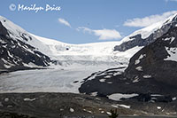
The glacier has retreated significantly since my last visit, in 1964...
The photo on the left was taken on this trip from the Visitor's Center. The photo on the right was taken from almost the same spot and close to the same perspective in August 1964. (My thanks to my brother for scanning a bunch of Mom and Dad's slides. This photo is from that scanned collection.)
The gravelly hill at the base of the glacier in this year's photo was built up as the glacier alternately grew and retreated over the years and masks the "toe" of the glacier. In the photo from 1964, the toe of the glacier is clearly visible and is located almost exactly over the gravel moraine in today's photo.
Later this day, we'd climb this moraine to get closer to the toe. If we had been in the same spot in 1964, we'd be on the ice itself. There were large signs along the road to the gravel moraine showing where the toe of the glacier was over the years. The current parking area was farther from the main road than the 1960 marker...
We got in line for the first bus, a regular tour bus, at the assigned time. It took us to a change over place to get onto the special buses that can go onto the glaciers. These have really, really big tires and super granny gears.
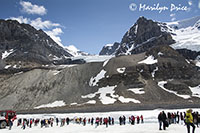
Then it was up to the glacier, where we spent about 25 minutes on the area they had made safe for the general public.
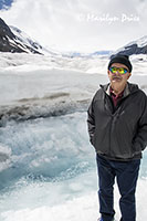
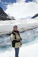
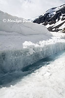
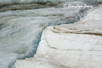
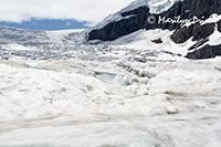
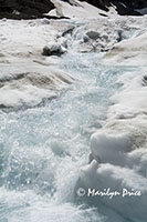
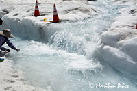
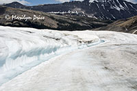
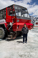
The first three photos were taken in that open area. The photo on the left is Carl in front of the water that was pouring off the Athabasca Glacier as it melted. The center photo is, of course, me in about the same location. The photo on the right shows the channel that the melting ice has formed across the top of the glacier. We were among the few people there that weren't trying to use selfie sticks... The photo on the far left was taken as the bus climbed up to the glacier surface and shows a channel of melted water running along the side of our road.
These three photos also show the melting snow that was running over the top of the glacier. The photo on the right has someone attempting to fill a water bottle from this water. While we were assured it was safe to drink, we decided not to chance it...
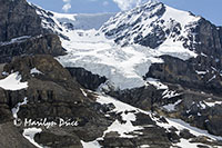
The photo on the left and the center photo are more photos of melting ice running off the glacier. The photo on the right shows another glacier hanging high above the Athabasca Glacier. The Columbia Ice Fields feed a number of glaciers in the area. Athabasca is the most accessible of them all. Waters from this Ice Field flow east to Hudson's Bay, north to the Arctic Ocean, and west to the Pacific Ocean.
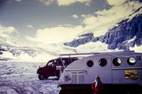
The photo on the left above shows some of the many people on this open area of the glacier at the same time we were there. Each of these big buses holds as many people as a typical tour bus (about 50) and there were five buses parked there most of the time. The center photo shows Carl standing in front of the huge bus we were on. The photo on the right is again from August 1964 and shows my sister, Jenny, standing next to the transports used at that time. They were called Snowmobiles and had catepillar tracks instead of wheels. They had smaller windows and only held about 15-20 people at a time. There was one parked outside the Visitor's Center while we were there on this trip as a museum exhibit. They looked small and cramped...
Then back over the moraines and down the hill to the original bus which returned us to the information center for some lunch. And, yes, it dropped us off at the entrance to the gift shop...
After lunch, we drove across the road to the parking lot for the glacier toe hike. The terminal moraine was a tall gravel pile that we scrambled up. We got a workout...
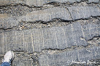
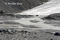
These three photos were taken from the viewpoint on top of the terminal moraine pile. The photo on the left shows the scarred rocks (and my shoe). The parallel lines were cut by rocks on the bottom of the ice that were drug across the underlying bedrock. The center photo shows the toe of the glacier with ice melt running off of it. The photo on the right is another section of the toe with the accumulating water carving a tunnel under the ice.
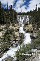
After our little hike, we drove on another 5 km farther north to see Tangle Falls. It's a really nice waterfall! Well worth the extra distance.
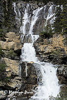
These three photos are of Tangle Falls.
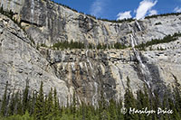
Then we drove back to Banff, stopping at the Weeping Wall (photo on the right) and a couple of other places.
The Weeping Wall is a cliff with a number of small, tall waterfalls.
The photo on the left shows more of the mountains lining the Icefields Parkway.
.
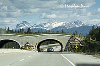
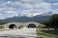 These two photos show something that I wish more countries would emulate. These are overpasses that allow wildlife to safely cross this very busy roadway. There are about a half dozen of them between Lake Louise and Banff.
I understand that they have verified (by hidden infrared cameras) that it didn't take long for the wildlife to learn just what these were for. They're used very regularly, especially at night, and have undoubtedly saved a large number of animal lives.
We decided to have a more simple dinner tonight – pizza and pints sounded perfect. We asked for a local recommendation and it worked out very well. Athena Pizza was perfect.
We crashed early and slept well. It had been a long day.

