June 27
June 28
June 29
June 30-July 2
Tuesday, June 27
We finally got up at 6:30, ate breakfast at the hotel, packed up, and headed west.
Our first stop was at Mt. Rushmore National Memorial. It's changed a lot in the last 14 years. Mostly in the parking. There's a big fancy parking garage in front of the Memorial now. We got a spot in the shade and headed into the park itself.
We did opt for the audio tour wands for our visit. They were well worth the price! Lots of information and included some audio clips from construction days. We did the full walking tour, which is also worth the time it takes.
The skies were clear blue when we arrived and the temperature kept climbing. By the time we left the clouds were rolling in.
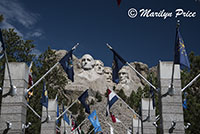
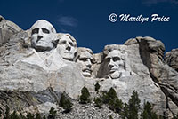
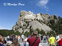
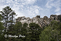
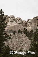
These three photos were taken in the main viewing area, where the Visitor's Center, souvenir shop, and such are located. The photo on the left shows the Avenue of State Flags that you pass through on the way to the overlook area. The center photo is what the sculpture looks like from the viewing overlook. The photo on the right not only shows the sculpture, but also the hoards of people crowding this viewpoint. Very few of them proceded beyond this point to take the walking tour along the base of the sculpture.
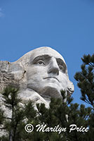
All three of these photos were taken on the walking tour. The photo on the left looks straight up through the trees at George Washington. The other two photos show the view from the studio are of the park, which has a nice exhibit showing the scale model that the workers worked from and explained some of the tools used to sculpt the mountain and to scale the scale model onto the physical surface.
We got back to the Visitor's Center just before lunch time to find that the cafe was very crowded, even though it was 1:30. So, instead of lunch, we had a dish of ice cream each...
So, we turned in the audio wands, returned to the car, and continued on to Custer (the town). We checked into our hotel, then took off again to Custer State Park.
Today, we took the Needles Highway. It's very, very interesting. And very, very crooked.
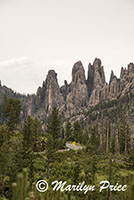
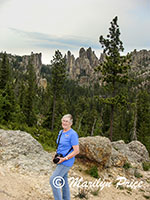
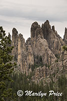
These three photos were taken at one of our stops on the Needles Highway, deep in the heart of the Cathedral Spires. The photos on the left and right show some of the rugged formations that give the Cathedral Spires their name. The center photo has me with the Cathedral Spires as a backdrop. The clouds were really thick by this time.
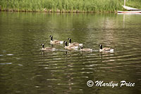
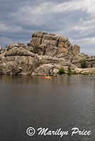
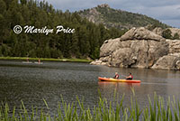
Our last stop of the day (still in Custer State Park) was at Sylvan Lake, a popular swimming and paddling area. The photo on the left shows a flotilla of ducks crossing one end of the lake. The center photo shows a couple of kayakers (two person kayak) near some of the massive rocks that dot this pretty lake. The photo on the right shows the kayakers in the foreground and a couple of stand-up paddle boaters sharing the lake.
We were almost back to Custer (the town) when the skies opened and the winds started howling. The horizontal rain was so heavy that the road disappeared in front of us. We pulled over into a grocery store's parking lot to let it settle down around us. We finally made it back to the hotel. We watched the temperature drop 15 degrees in three minutes.... Now, to find a decent restaurant for dinner that has electricity (most of downtown is dark)....
Dinner was at the Dakota Cowboy Cafe, which was about the only place in town that still had electricity, which meant that the line for dinner was pretty long. We had a 45 minute wait for a table. It's large sign got broken off by today's wind... Carl had taco salad, I had quesadilla. <
Then back to the hotel where we watched end of Independence Day (the first one).

